Gerald Persons did not set out to reshape North American geography. He set out to catch walleye. He brought a thermos of coffee, a tackle box he'd owned since the Eisenhower administration, and the unshakeable conviction of a retired man with nowhere to be and nothing to prove. What he did not bring — and this turned out to be relevant — was any particular respect for being told he was wrong.
By the time the argument was over, the United States and Canada had quietly adjusted their shared border by nearly two miles. Gerald Persons went home and probably had a sandwich.
A Retired Man, a Familiar Lake, and an Unfamiliar Problem
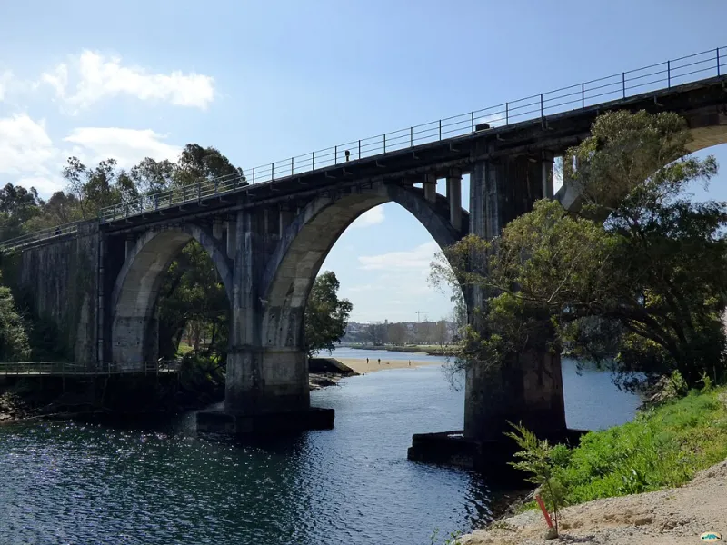
The boundary between Minnesota and the Canadian province of Ontario traces one of the more complicated lines on the North American map. It winds through the Boundary Waters — a vast, island-dotted network of lakes and rivers that has been canoe country for centuries — following a route established by treaties in the early 1800s and refined (in theory) by subsequent surveys. In practice, the line was always a bit approximate. There are a lot of islands out there. The water all looks the same.
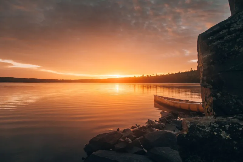
Gerald Persons had been fishing these lakes since childhood. He knew the water the way people know their own neighborhoods — by feel, by habit, by accumulated memory. In the summer of 1974, he paddled out to a spot he had fished dozens of times, set up near a small rocky outcropping, and commenced the serious business of doing very little.
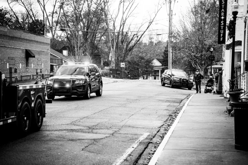
That's when the U.S. Border Patrol boat appeared.
The officer informed Persons that he was in Canadian waters and would need to either produce documentation for an international crossing or return to the American side. Persons, by all accounts a man of firm opinions, informed the officer that he was not in Canadian waters. He was in Minnesota. He had always been in Minnesota at this spot. He had been fishing here since before the officer was born.
The officer disagreed. Persons did not budge. A citation was issued.
The Ticket That Launched a Federal Review
Persons contested the citation. This was, on its face, a fairly minor bureaucratic matter — a retired fisherman disputing a border patrol ticket in a local administrative hearing. Except that in order to contest it, Persons needed to demonstrate that the location in question was actually on the American side of the international boundary.
This required consulting the official maps.
The official maps, it turned out, were not entirely consistent with each other.
The boundary in that section of the Boundary Waters had been charted multiple times over the decades — first by British and American surveyors in the 1820s following the Treaty of Ghent, then again in the 1840s, then as part of a broader international boundary commission survey in the 1870s. Each successive survey had introduced small variations, and those variations had never been fully reconciled. The maps that U.S. Border Patrol was using in 1974 reflected one version of the line. Other maps, including some held by the Army Corps of Engineers and the U.S. Geological Survey, reflected slightly different versions.
Persons's attorney — who appears to have been as stubborn as his client — filed a formal challenge arguing that the citation was invalid because the boundary at the relevant location was legally indeterminate. This was not the kind of argument that administrative hearing officers were accustomed to handling.
Two Governments, One Embarrassing Admission
The challenge worked its way upward through federal channels until it landed at the International Boundary Commission, the joint U.S.-Canada body responsible for maintaining the official demarcation of the shared border. The IBC launched a formal review of the relevant section of the Minnesota-Ontario boundary in 1975.
What they found was not exactly a crisis, but it was not comfortable either. The original 1820s survey in that region had used measurement techniques that were standard for the era but produced results that didn't quite match the actual geography of the lake system. Subsequent surveys had attempted to correct for this but had done so inconsistently, creating a layered accumulation of small errors that had never been formally addressed.
The specific area where Persons had been fishing sat in a zone where, depending on which survey you trusted, the boundary ran anywhere from a few hundred yards to nearly two miles from where Border Patrol had been enforcing it.
After two years of review, field surveys, and bilateral negotiations, the IBC issued a formal correction to the boundary in that section. The adjusted line moved the official demarcation point roughly 1.8 miles from its previously enforced position. The rocky outcropping where Gerald Persons had been fishing was confirmed to be on the American side.
The citation was dropped.
The Century-Old Error Nobody Wanted to Find
What makes this story genuinely remarkable isn't just that one man's stubbornness triggered a federal geographic review. It's that the underlying error had been sitting there for over a hundred years, unnoticed or at least unacknowledged, before a retired fisherman with a thermos and a grievance accidentally flushed it into the open.
Border Patrol had been enforcing a line that wasn't quite right. Cartographers had been printing maps that didn't fully agree with each other. Two national governments had been operating under a shared boundary that contained a quiet inaccuracy neither side had any particular incentive to investigate.
It took one ordinary person, doing an ordinary thing, refusing to accept an ordinary ticket, to make the whole apparatus stop and take a harder look.
The IBC's 1977 correction was made quietly, without fanfare. There was no press conference. No one sent Gerald Persons a letter of thanks. The updated boundary was simply incorporated into subsequent maps, and the old error was retired without ceremony.
Persons, for his part, reportedly went back to fishing the same spot the following summer. He brought the same thermos. He caught walleye. The border, now correctly drawn, ran exactly where he had always said it did.
Some people are just right about things. It just takes the rest of the world a while to catch up.